Showing posts with label coast guard. Show all posts

Wednesday, September 5, 2012

Ask An Astronaut!


Ever wanted to know what it’s like to be an astronaut?  If you’re reading this blog the answer is most likely yes.  Well you’re not alone, gentle reader, and with good reason.

The Coast Guard asked their Facebook fans if they could ask an astronaut one question what would it be? Then they took the top five most “liked” and asked them to retired Coast Guard Capt. Daniel Burbank, commander of International Space Station Expedition 30.

Thanks to all of our fans who submitted questions!


Video provided by the US Coast Guard via their YouTube channel

Wednesday, May 9, 2012

Katrina Changed Everything: New Software for Flooding Protection


Homeland Security's Science & Technology Directorate and Dams Sector partners team up to develop new software systems for fast simulation of catastrophic flooding

"…to Thomas Coleman , a retired longshoreman who died in his attic on St. Roch Avenue in New Orleans 8th Ward on or about Aug 29th, 2005. He had a can of juice and a bedspread at his side when the waters rose….There were more than a thousand like him."
 - Chris Rose, 1 Dead in Attic

All over the country, millions of Americans still live behind dams or levees, and if these were to fail and unleash catastrophic flooding, as some did in New Orleans in 2005, property, and of course life, might once again pay the price. "Oh, my city... in case you haven't heard, Budweiser ain't delivering," Rose grieved, with a surreal humor and poignancy only a true New Orleans survivor could muster. "Katrina changed everything."

Answers to at least some of the problem are now on the way, thanks to a team led by the Department of Homeland Security's (DHS) Science and Technology Directorate (S&T), and they come in the form of some remarkable computer software.

When dam and levee owners and emergency planners want to know what flood water over a breached levee or dam may do as it spreads, they must resort to technical specialists who use numerical modeling software to solve very complex equations that describe how water will spread over a particular terrain. Through complex equations, specialists calculate how water will move around physical objects such as hills, buildings, vegetation, bridges, and railroads. With such factors in play, calculating and modeling flood inundation caused by a dam failure can take a lot of time and resources and keep emergency planners and dam owners up at night worrying.

Powerful software tools have been combined into a seamless Web application, combining speed with sophisticated technology to visualize a flood, address consequences, and properly train emergency responders.

And this new tool is fast. Really fast. If a flood would take 24 hours to inundate downstream areas, this software tool could potentially model the inundation in less than 24 minutes.

S&T combined the talents of several agency experts and academics to better understand what the owners and operators would need from the software. S&T worked with dam experts at the Office of Infrastructure Protection (which serves as the Dams Sector-Specific Agency) within the DHS' National Protection and Programs Directorate to develop the flood simulation tool, and with experts at the University of Mississippi - specifically the National Center for Computational Hydroscience and Engineering (UM-NCCHE)'s world-renowned computational hydroscientist, Mustafa Altinakar, and his team.

This effort was funded by S&T's Southeast Region Research Initiative (SERRI) and managed by S&T's Infrastructure Protection and Disaster Management Division's Mike Matthews. The key component of the project is DSS-WISE™ (Decision Support System for Water Infrastructural Security) and the underlying flood simulator, CCHE2D-FLOOD™, which provides unmatched ‘number-crunching' speed. The flood simulator can replicate flooding caused by any cataclysm less fateful than The Great Deluge: a breached levee, a failed dam, a surging tide, a tsunami - even water waves caused by massive landslides.

In 2010, when one-fifth of Pakistan's land was underwater, hydraulic engineers at the U.S. Army Corps of Engineers (USACE) used DSS-WISE™ to help the country reallocate resources. Time was essential, and to achieve its unprecedented speed, the "DSS-WISE™ guys," as Altinakar affectionately calls them, use several methods to ensure success. First, DSS-WISE™ selectively prioritizes affected regions. It also processes only the model's "skeleton," or wireframe, while applying the "skin" afterward. Finally, it divides the flood path model into tens of millions of geometric cells, using parallel processing to parcel them out to separate processors.

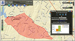
 The other critical piece of the puzzle is the Dams Sector Analysis Tool, or DSAT. This powerful Web-based application - developed by the Dams Sector-Specific Agency in collaboration with USACE Headquarters' Office of Homeland Security, who co-sponsored the development of DSAT - is a one-stop shop where dam owners and operators have secure access to state-of-the-art analytical capabilities within a user-friendly graphical environment. Dam owners and operators use algorithms in DSAT to identify and prioritize the most critical dams within their portfolios. Considering that there are more than 84,000 dams across the country, this is no easy task. DSAT also incorporates a state-of-the art geospatial viewer that provides powerful query capabilities as well as access to real-time information (earthquakes, weather, etc.).

The DSAT interface is extremely intuitive and mastered with little training. With DSAT, a dam owner or operator can prepare the input data required for the flood simulation using DSS-WISE™. For example, to characterize a potential dam failure scenario, operators would define the reservoir, identify the main dam, note structures using satellite imagery, and specify the type failure to be considered: a "sudden and complete failure" or a "gradual and partial breaching." DSAT does the rest - drawing data from the National Inventory of Dams (NID), maintained by the USACE. The data are then bundled into a data file and emailed to a dedicated server at Ole Miss, where the simulation is run. When the simulation ends, the server automatically notifies the user, who may then upload the results on DSAT, where they are rendered onto a map.

"It works similarly to Apple's Siri," says Altinakar, referring to the iPhone's intelligent digital assistant. "There's no way all that processing could occur in the user's computer - or phone - so it's handed off to an external server. It looks simple to the consumer, but I assure you, it's not."

 The two software systems - DSS-WISE™ and DSAT - are both effective enough to stand on their own, but their integration into a powerful system elevates the capacity for flood simulation. The DSAT geospatial viewer includes a function called DSS-WISE™ Prep. Select your dam on a map, fill in a few facts, direct DSAT how high the reservoir will be when the flood starts, and click Begin. The request is bundled into a data file and automatically sent to the DSS-WISE™ flood simulator. As the simulation unfolds, the consumer will not see heavy activity but will immediately receive automatic progress reports by email.

The DSS-Wise™ Prep module was launched on the DSAT portal on February 20, and days later, it welcomed its first user, delivering results in just 15 minutes. By March, queries poured in from dam owners, state dam safety officials, and emergency managers in seven states - each looking to lower costs, work faster, and make sounder planning decisions.

Like all SERRI projects, flood modeling projects have combined science and technology with validated operational approaches to solve local and regional problems that have a national impact.

Looking back on the tragedy of Katrina, writer Chris Rose ended his 2006 book with a chapter titled, "A New Dawn." In it he wrote:

"Last year ended with everything so unsettled; just a million questions piled up on the curbside like so much debris, the answers just beginning to be formulated in our heads…. It's just one small step at a time, small triumphs… Who says there's no good news?"

The powerful software from DHS - now easily available to dam owners and emergency planners - is just some of that good news.

Tuesday, March 13, 2012

Top 10 facts about the International Ice Patrol


1. When was the International Ice Patrol  formed?

Shipping areas in the North Atlantic have always been hazardous to navigate. The hazards of the North Atlantic captured global attention in April 1912 when the RMS Titanic  sank after it struck an iceberg. The incident prompted maritime nations with ships transiting the Grand Banks off Newfoundland, Canada, to establish an iceberg patrol in the area. Since 1913, the U.S. Coast Guard has been tasked with the management and operation of the patrol. Except for the years of World Wars I and II, the ice patrol has been active each ice season since its inception.

2. What are the specific duties of the ice patrol?

Their mission is to monitor the iceberg danger near the Grand Banks of Newfoundland and provide the iceberg limit to the maritime community, including ice and current conditions.

3. Who makes up the ice patrol?

The ice patrol is a U.S. Coast Guard unit however the Canadian Ice Service , ice patrol and U.S. National Ice Center  collaborate under the North American Ice Service . The ice patrol produces North American Ice service reports from February through July when icebergs may be present on the Grand Banks and the Canadian Ice Service produces the reports the rest of the year when icebergs are normally restricted to Canadian coastal waters.

4. Why aren’t there ice patrols in other areas other than the Grand Banks?

This is the only location in the world where icebergs endanger a major shipping route, and the ice patrol provides accurate and timely iceberg information to assist transatlantic mariners in avoiding them. Maritime traffic between Europe and North America typically follows routes that are intersected annually by an average of 500 icebergs.

5. What defines an “ice season” and when is it?

The ice season is the seasonal period when icebergs can be present on the Grand Banks. The International Convention for the Safety of Life at Sea  the “ice season” as the period between February 15 and July 1, however the commander of the ice patrol can extend the period based on conditions.

6. What is the International Convention for Safety of Life at Sea?

SOLAS – or the International Convention for Safety of Life at Sea – is generally regarded as the most important of international treaties concerning the safety of merchant ships. The first version was adopted in 1914, in response to the sinking of the Titanic. The main objective of SOLAS is to specify minimum standards for the construction, equipment and operation of ships, compatible with their safety.

7. How did the Coast Guard patrol for icebergs in the past?

Iceberg detection in the past relied on visual sightings from boats on patrol in the area. As airplane performance improved however, the ice patrol integrated airplanes into reconnaissance operations and after 1960, surface patrol craft took a secondary role to aerial reconnaissance.

8. How does the Coast Guard patrol for icebergs now?

Iceberg reconnaissance is conducted primarily with aircrews from Air Station Elizabeth City , N.C., in an HC-130J Hercules  airplane, the perfect platform for their mission. Using the airplane’s specialized sensors, radar and visual observations are employed for iceberg detection and identification.

9. Why do modern vessels still need the ice patrol?

The seas where the North Atlantic shipping lanes pass near the Grand Banks are particularly challenging for mariners due to frequent fog and high seas. The combination can make it extremely difficult for even a modern vessel to detect an iceberg and avoid it. If there were no ice patrol, vessels would have to reduce risk of collision by either slowing speed considerably or avoiding the Grand Banks entirely. Every additional sea mile or hour adds to transportation costs and delivery time. In this age of “just in time” delivery, longer and more costly voyages equal higher costs and higher prices for consumers.

10. Are icebergs really still a danger?

As recently as 2010, a vessel ignoring the ice patrol’s warnings collided with an iceberg. Fortunately the damage was not catastrophic and the vessel was able to divert to a safe port. The vessel required considerable hull repairs and was unable to return to sea for some time. No vessel heeding ice patrol’s warnings has ever collided with an iceberg.

Check out the International Ice Patrol ‘s website for more information, or you can read about the opening  of the 2012 season.

Thursday, February 2, 2012

East Coast Students to Speak Live With Space Station Commander

Ann Marie Trotta
Headquarters, Washington

Rachel Kraft
Johnson Space Center, Houston

WASHINGTON -- Students participating in a U.S. Coast Guard Academy mentoring program will speak with Expedition 30 Commander Dan Burbank aboard the International Space Station at 11:15 EST on Thursday, Feb. 2.

Burbank, a NASA astronaut and retired Coast Guard captain, will talk to kindergarten through 12th-grade students about life on the space station. The event, hosted by the academy, will be broadcast live on NASA Television and include video of Burbank in the live question-and-answer session.

The mentored students, accompanied by their Coast Guard cadet mentors, will participate from five schools across the Eastern seaboard, including Science and Technology Magnet High School of Southeastern Connecticut in New London, Conn.; The Friendship Academy of Engineering and Technology in Baltimore; Coretta Scott King Young Women’s Leadership Academy High School in Atlanta; Key Biscayne K-8 Center in Miami; and Maritime and Science Academy, also in Miami. Through the guidance of their mentors, students are learning about space and preparing for this interactive event.

Burbank and Russian cosmonauts Anton Shkaplerov and Anatoly Ivanishin arrived at the station Nov. 15. NASA’s Don Pettit, cosmonaut Oleg Kononenko and European Space Agency astronaut Andre Kuipers joined the crew on Dec. 23.

This in-flight education downlink is one in a series with educational organizations in the United States and abroad to improve STEM teaching and learning. It is an integral component of NASA's Teaching From Space education program, which promotes learning opportunities and builds partnerships with the education community using the unique environment of space and NASA's human spaceflight program.

The exact time of the downlink could change. For NASA TV downlink, schedule and streaming video information, visit http://www.nasa.gov/ntv.

For information about NASA's education programs, visit http://www.nasa.gov/education.

For information about the International Space Station, visit http://www.nasa.gov/station.

To follow Twitter updates from Burbank, visit http://twitter.com/AstroCoastie.

- end -

Friday, January 20, 2012

New Museum App Released on iTunes and Android Market

Pensacola, Fla.– January 19, 2012 – To start the new year, download the official app of the National Naval Aviation Museum from iTunes and the Android Market. Located aboard NAS Pensacola, Florida, the National Naval Aviation Museum is one of the world’s largest aviation museums with over 350,000 square feet of displays and more than 150 beautifully restored aircraft representing Naval, Marine Corps and Coast Guard Aviation.

The National Naval Aviation Museum app is your go to source for information on the Museum aircraft and exhibits including exclusive photos and videos. Featuring an interactive map of the Museum and comprehensive guide to the collection, users have the ability to build their own tours, learn more details of the aircraft and displays, and keep track of upcoming events and museum news.

Cost for the app is $1.99 and all proceeds support the Museum, the Naval Aviation Museum Foundation and its mission to “Inspire and Educate” the public through the history of Naval Aviation. Last fall, the Foundation also released the official Blue Angels app also available on iTunes and the Android Market.

Features include:

•    Interactive map of the facility giving you instant access to the Museum collection.
•    Detailed descriptions, photos and multi-media of over two hundred Museum exhibits and aircraft.
•    Create your own tour of the Museum or select one of our pre-built tours to act as your digital docent.
•    Museum Twitter and Facebook feeds for the latest news and updates.
•    A complete listing and guides to Museum activities, upcoming events, Blue Angels practice schedule and new exhibits.

Media Note: For more information about the National Naval Aviation Museum and Apps, contact Shelley Ragsdale or Donald Watson, Naval Aviation Museum Foundation, Inc. at (850) 453-2389 or by e-mail at sragsdale@navalaviationmuseum.org or dwatson@navalaviationmuseum.org.

About the National Naval Aviation Museum
The National Naval Aviation Museum features nearly 350,000 square feet of displays and is one of the world’s largest aviation museums. Located aboard Pensacola Naval Air Station, the facility boasts more than 150 beautifully restored aircraft representing Navy, Marine Corps and Coast Guard aviation, and is Florida’s most-visited museum. Be sure to visit the Museum’s new expansion, Hangar Bay One, displaying aircraft of the post- WWII era including Marine One presidential helicopter. Among the countless things to touch, see and experience are thrilling 3D MaxFlight simulators and a variety of special exhibits, as well as the drama and power of amazing IMAX® films. The Cubi Bar Café offers a unique dining experience, and the Flight Deck Store is the perfect place to find a memento of the spirit of Naval Aviation. Museum admission is free. The National Naval Aviation Museum is open daily from 9 a.m.–5 p.m., except Thanksgiving Day, Christmas Day and New Year’s Day. For more information, visit www.NavalAviationMuseum.org.

Tuesday, July 19, 2011

The Coast Guard's Arctic Agenda Heats Up

The Coast Guard charts a course for basic research before Arctic travelers find themselves on thin ice.

If regions were given hospitality rankings, the Arctic would fall somewhere between zero and below zero stars. Temperatures can plunge to −60°F, and winds can exceed 75 mph. Half the year, skies are black, making icebergs dangerous obstacles.

Still, the Arctic is critical to U.S. commercial and homeland security interests. In 2009, President Obama issued National Security Presidential Directive 66 / Homeland Security Presidential Directive 25, outlining the administration's Arctic Region Policy. The U.S. Coast Guard, a component of the Department of Homeland Security (DHS), plays a critical role in implementing this policy. Their mission includes securing international commerce, protecting the environment, defending America's maritime borders, and saving those in peril at sea or on other navigable waterways.

"In the near future, the Coast Guard will face challenges posed by increased commercial shipping, resource exploration, and recreational activity in that part of the world," says DHS program manager Theo Gemelas, who oversees two Centers of Excellence at the Department's Science and Technology Directorate (S&T). The Coast Guard's research planners are examining the future capability and technological needs of its operators. To ensure that tomorrow's Arctic guardians will get the tools they'll need, the Coast Guard must devise innovative solutions today.

Last fall, in collaboration with the U.S. Arctic Research Commission and the Coast Guard, DHS S&T hosted a 3-day workshop, "Operating in the Arctic: Supporting the U.S. Coast Guard Challenges through Research," at the University of Alaska at Fairbanks (UAF). The workshop brought together Coast Guard operational experts, academic researchers, Alaskan locals, scientists, and Canadian counterparts to define the research needs.

"Knowing what's in the water, on the water, and above the water will be critical to the Coast Guard's ability to execute its statutory missions. S&T is facilitating this important research," Gemelas said.

The workshop participants canvassed work already underway by the Department of the Interior, the Office of Naval Research, the Coast Guard Research & Development Center, the National Academies of Science and other organizations conducting research focused on the specific challenges. Three working groups focused on the following research areas:

Infrastructure: The distance between base sites in the Arctic can make it difficult to conduct rescue missions—the nearest operational base is 1,000 miles south, in Kodiak, Alaska—but building more bases presents its own challenges. Close-in sites may require large, heated hangars, which would likely call for rigorous design and construction criteria to guide architects, engineers, and builders, given the Arctic's inhospitable conditions. Until these criteria are met, the Coast Guard and its planes and helicopters will remain out in the cold.

Communication: When a distress call arrives, the Coast Guard must respond. But it can't respond to a call it can't hear, and the communications infrastructure in the Arctic region is limited. There are few radio repeaters—electronic devices that receive a signal and retransmit it, more powerfully, to extend its range. There also are no ship-to-shore cables or cell towers, nor sources to power them. So researchers are working to identify and develop communication systems appropriate for operators in this environment. If a distress call is heard, the nearest potential rescuer may be a local fisherman. In the future, the Coast Guard hopes to hear every distress call and contact the nearest ship in minutes—and even aims to monitor the rescue on a video screen.

Sensors: Sensors are critical to the Coast Guard's awareness of activities in the Arctic. Navigation, heat, sound, and other data from sensors placed in a variety of locations – on planes, ships and buoys and in space, at ground stations and on the sea floor – must be combined and sorted into a comprehensive, useable format in order to be helpful to Coast Guard operators. A network of sensors will help answer a potpourri of questions: How thick is this ice? How deep is that seafloor? Has oil spilled, and if so, how fast is it spreading and whither? Are aircraft wings or blades about to ice up? Where are the marine mammals? How many are there? Are they healthy?

In addition to a number of creative research ideas, the S&T workshop led to a funding opportunity announced in February 2011 by the DHS Center for Island, Maritime, and Extreme Environment Security (CIMES) at the University of Hawaii. "This research is an investment in the future of America's maritime security by people working at the cutting edge of science and technology applied to nationally relevant problems," says Gemelas.

And that's just the tip of the iceberg.

Wednesday, June 22, 2011

NASA Sets Sail on Second Leg of Arctic Ocean Research Voyage

Steve Cole
Headquarters, Washington                                   

WASHINGTON -- Scientists embark this week from Alaska on the second and final campaign of a NASA field campaign to study how changing conditions in the Arctic affect the ocean's chemistry and ecosystems.

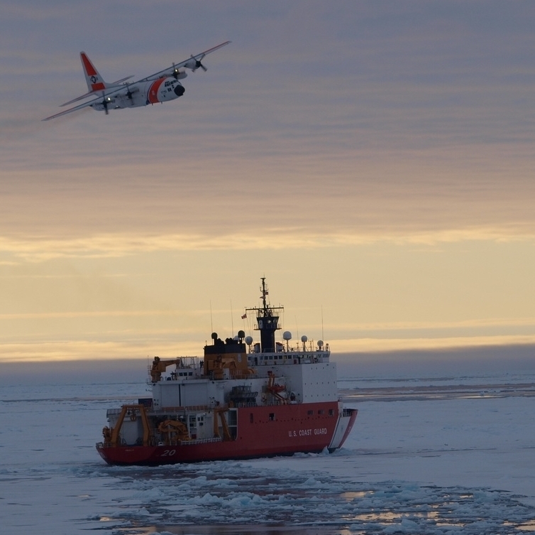
On June 25, the ICESCAPE mission, or "Impacts of Climate on Ecosystems and Chemistry of the Arctic Pacific Environment," resumes its shipborne investigation of the impacts of climate change in the Chukchi and Beaufort seas along Alaska's western and northern coasts. Research teams depart from Dutch Harbor, Alaska, aboard the U.S. Coast Guard Cutter Healy.

The field campaign takes 47 scientists for five weeks to the Arctic Ocean, where a variety of instruments will be used onboard the Healy and deployed into the ocean and on the sea ice. Following the mission's first campaign in summer 2010, the second year of sampling seeks to find year-to-year differences and provide data for new lines of investigation.

Combined observations from the field and from NASA satellites are critical to understanding the Arctic, where the signals of climate change are amplified. The accelerated decline of Arctic sea ice extent and thickness exemplifies this trend, and scientists want to know how this change affects other ocean processes and marine life.

"Multidisciplinary field campaigns like ICESCAPE take advantage of simultaneous satellite and field measurements," said Carlos Del Castillo, acting program manager of the Ocean Biology and Biogeochemistry Program at NASA Headquarters in Washington. "The advantage of satellites is that we can routinely collect observations of the whole planet. That data combined with field work and computer modeling gives us a better understanding of how the Earth system works."

Phytoplankton, microscopic organisms that live in watery environments, are a key focus of the campaign. They form the base of the aquatic food web, participate in cycling Earth's carbon between the atmosphere and the ocean and are susceptible to climate change. NASA has monitored changes in phytoplankton from space worldwide with the Moderate Resolution Imaging Spectroradiometer instrument on the Aqua satellite and the Sea-viewing Wide Field-of-view Sensor, which ended observations in 2010.

"Last year, ICESCAPE nailed down quite a few things in terms of the phytoplankton work," said Kevin Arrigo of Stanford University in Palo Alto, Calif., the mission's chief scientist. "We know pretty well now how fast they are growing and what they are responding to. The repeat measurements from this voyage will help us confirm what's going on."

The 2010 campaign gave researchers a glimpse of what might be happening in Barrow Canyon, one of most productive areas for phytoplankton growth in the Beaufort-Chukchi region. While many blooms last just a few weeks before consuming all of the local nutrients and declining, the bloom in Barrow Canyon gets its start in spring and carries on through summer.

Scientists think the extended bloom can be explained by unique patterns in the path and timing of ocean currents. In spring, a stream of water carries nutrients from the Pacific Ocean up through the Bering Strait and delivers them to Barrow Canyon. The water hugs the coast and arrives quickly, providing the nutrients for the bloom to get its start. Two other streams take a more circuitous route and arrive later, sustaining the bloom through summer.

"With this year's voyage, we hope to acquire more details about the physical processes pulling nutrients from deep water to the surface," Arrigo said.

New to ICESCAPE in 2011, the ship will forge north through the Beaufort Sea to explore the relationship between shallow water on the continental shelf and deep water in the Canada Basin. Phytoplankton on the shallow shelves tend to flourish when the ice retreats and scientists want to find out what feeds the bloom.

Last year, researchers saw some indication that nutrients were moving between deep and shallow water. Wind unexpectedly blew thick, multiyear sea ice south to the edge of the shelf, at some places up to 20 feet thick. The ice proved too thick for the icebreaker to penetrate. The Healy, the newest and most technologically advanced U.S. polar icebreaker, is designed to break four-and-a-half feet of ice continuously at three knots.

This year, the field campaign begins two weeks later, which means the Healy is expected to encounter thinner, summer ice and thus have a better chance of exploring the ecosystems in water that spends most of the year under a blanket of ice.

For updates on the five-week ICESCAPE voyage, visit the mission blog at http://go.usa.gov/WwU.

For more information about NASA and agency programs, visit http://www.nasa.gov.

- end -